
- 🗺️ WMS/WCS · OGC Standards · NetCDF · Shapefile · GeoJSON
Geographic Information System
Powerful geospatial weather intelligence with full GIS integration for mapping,
analysis, and decision support — native to ArcGIS, QGIS, and custom geospatial
workflows.
OGC Compliant
OGC Compliant
OGC Compliant
OGC Compliant
📂
50+yr
OGC
Standards Compliant
📊
100+
Weather Variables
🗄️
NetCDF
Native Support
OpenGIS®-based framework
- Seamlessly fits any Geographic Information System (GIS)
- All CustomWeather map layers are also available as SHAPE files
- Individual map layers can be dynamically plotted on client-supplied base maps or on CustomWeather’s high color, topographical base maps as a default
- Maps parameters are fully customizable – CustomWeather clients choose their own bounding coordinates, map sizes, weather variables, cities, output format, borders, and even the satellite contrast to be used
- Map data can be displayed in real-time or animated over time
- Dozens of pre-generated maps are available to choose from if preferred
- Map server is designed to fit into any map system

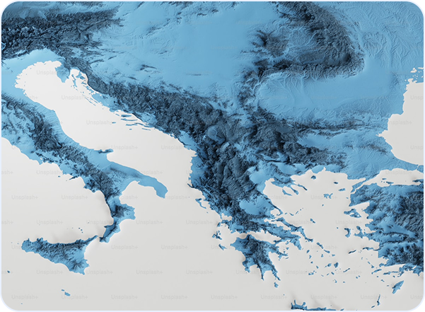
CustomWeather’s universal map server produces maps in real-time for client-specified needs through an easy-to-use http interface. All CustomWeather content is location-based, providing relevant weather information for over 80,000 locations worldwide.
- Infrared satellite
- Infrared satellite
- Doppler radar
- Current conditions
- Severe weather warnings and watches
- Frontal maps
- Hurricane Tracking Maps
- Precipitation forecasts
- Real-time rainfall analysis
- Temperature contours
- Earthquake reports
- Wind plots
- Humidity
- Clouds
Real-World Applications
GIS for Every Sector
From emergency operations to climate research — spatial weather analysis powers
critical decisions in every industry.
🚨
Emergency Management
Situational awareness dashboards overlaying storm tracks, flood zones, and asset locations for rapid incident response.
Incident command
Evacuation planning
Resource allocation
🚨
Agriculture & Soil
Combine weather grids with field boundaries for irrigation scheduling, frost risk modeling, and crop stress monitoring.
Irrigation demand
Frost alerts
Yield modeling
🚨
Energy Planning
Wind and solar resource assessment, demand forecasting overlaid on grid infrastructure for capacity planning.
Wind resources
Solar potential
Demand forecasting
🚨
Urban Planning
Heat island mapping, flood risk zoning, and green space optimization using high-resolution weather analysis.
Heat mapping
Flood zoning
Climate planning
🚨
Insurance & Risk Modeling
CAT model inputs, climate scenario analysis, and historical loss attribution by geography and peril.
CAT models
Risk assessment
Loss attribution
🚨
Environmental Monitoring
Track climate trends, analyze historical weather impacts on ecosystems, and model future scenarios by region.
Climate trends
Ecosystem impacts
Scenario modeling
Incident command
GIS for Every Sector
SUPPORTED FORMATS
.shp
Shapefile
Vector format, ESRI standard
.json
GeoJSON
Web-ready vector format
.nc
NetCDF
Gridded binary (CF-compliant)
.tif
GeoTIFF
Georeferenced raster
.csv
CSV
Point data with attributes
.gpkg
GeoPackage
SQLite vector/raster
OGC Standards
WMS 1.3
Web Map Service
WCS 2.0
Web Coverage Service
Read
OGC GeoTIFF
GeoTIFF standard
Export
CF NetCDF
Climate & Forecast conventions
Read/Export
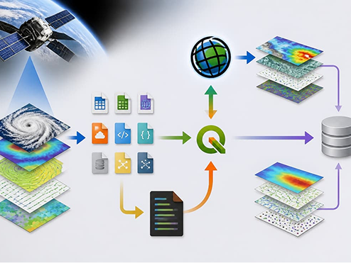
🔗
ArcGIS Server REST
Native ArcGIS integration via REST endpoints and Web Adaptor support.
🐍
Python/R Libraries
arcpy, rasterio, xarray integration for programmatic data access.
⚙️
Workflow Automation
Scheduled tasks, triggered processing, and automated exports to cloud storage.